Best Day Hikes Near Munich (Reachable by Train)
Twelve day hikes from Munich with no car needed: the actual train, the actual bus, the real height gain, and an honest verdict on which are worth your Saturday.
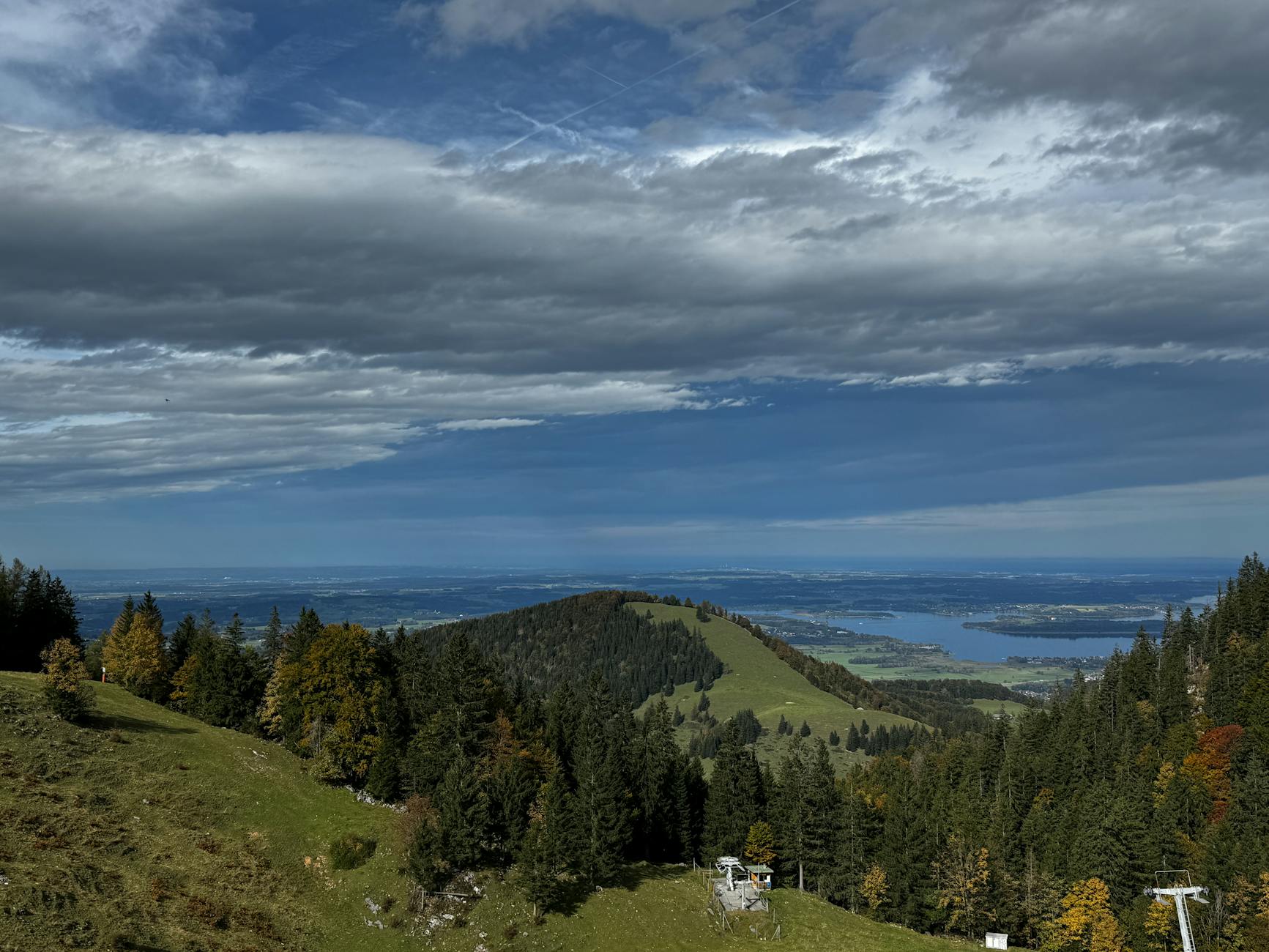
You can be standing on a 1,700-metre ridge with the Karwendel in front of you and a turquoise lake below, ninety minutes after leaving Munich Hauptbahnhof, without ever touching a car. That is the whole case for hiking near Munich, and it is the reason the city is unusual among European capitals of its size.
The catch is that the good walks are not evenly distributed, and the ones the search results push at you are not always the ones worth your Saturday. Some are two hours of forest track for a view you could have had from the train. Some need a bus that runs four times a day. And one of the most famous — the Herzogstand-to-Heimgarten ridge — is genuinely exposed and gets people into trouble every summer.
Below are twelve day hikes reachable from Munich on public transport, with the actual train, the actual bus, the actual height gain, and a straight answer on which ones are worth the journey.
Hiking near Munich at a glance
| Hike | Getting there | Distance / ascent | Time on foot | Verdict |
|---|---|---|---|---|
| Herrsching → Kloster Andechs | S8, ~45 min | 4 km each way, 140 m | 1h15 up | The best first hike |
| Osterseen circuit | Train to Iffeldorf, ~53 min | 10–12 km, ~50 m | 3 h | Flat, beautiful, underrated |
| Herzogstand | Train to Kochel + bus 9608 | 2–2.5 h up on foot | 4–5 h | The classic. Cable car optional |
| Herzogstand → Heimgarten ridge | as above | 15 km, 1,100–1,200 m | 6–8 h | Exposed. Not for everyone |
| Wendelstein | BRB RB55, ~80 min | 12.6 km, 1,050 m | ~5 h | Or ride the cog railway, €43 |
| Blomberg, Bad Tölz | BRB, ~55 min | 7.6 km, 500 m | 3–4 h | Best with children |
| Wallberg, Tegernsee | BRB RB57 + bus, ~1h30 | ~1,000 m | 2h30 up | Steep, honest, great summit |
| Prinzenweg, Schliersee → Tegernsee | BRB, ~60 min | 14 km, 600 m | 4h30 | Two valleys, one walk |
| Partnachklamm, Garmisch | RB6, 1h20 | 700 m gorge + loop | 1–4 h | Spectacle, not a hike |
| Eibsee circuit | RB6 + Zugspitzbahn | ~7.5 km, flat | 2 h | Pair it with the Zugspitze |
| Isar, Wolfratshausen north | S7, ~35 min | 10–15 km, flat | 3–4 h | Any season, any weather |
| Ammersee west shore | S8 + boat | flexible | 2–5 h | The lazy option, unapologetically |
The ticket that makes all of this cheap
Before the hikes, the arithmetic — because getting this wrong is the single most expensive mistake day-walkers make.
- The Bayern-Ticket costs €34 for one person and €74 for a group of up to five. It covers unlimited regional travel — RB, RE and S-Bahn — across the whole of Bavaria for a day, plus the regional buses in most of the areas below. For two people it is already cheaper than two returns to Garmisch. For four it is not close.
- It is not valid before 09:00 on weekdays. On Saturdays and Sundays it runs from midnight. This matters more than it sounds: a 09:02 departure to Kochel gets you walking at about 10:30, which is fine in July and marginal in October.
- It is not valid on ICE or EC trains. None of the hikes here need one, but do not use it to shortcut a journey via a fast train.
- Trailheads inside Zone M — the Isar path south of the city, the English Garden’s northern half — are covered by the ordinary Zone M day ticket at €10.10. Wolfratshausen sits at the far end of the S7 outside Zone M, so check the zone before you buy.
Our guide to Munich travel passes works through the whole ticket family, and day trips from Munich by train covers the non-walking destinations on the same network.
Insider tip: buy the Bayern-Ticket from a DB machine rather than the MVG app. The MVV app sells MVV products; the Bayern-Ticket is a Deutsche Bahn product and the two do not always talk to each other cleanly. The paper version also lets you write in five names at the machine rather than fumbling with a phone on a platform.
The easy ones: no mountain required
Herrsching to Kloster Andechs — the one to do first
If you only walk once near Munich, walk this one. The S8 runs to Herrsching on the eastern shore of the Ammersee, every twenty to forty minutes, and terminates there — so you cannot miss the stop. From the station the Kiental path follows the Kienbach up a wooded ravine to the monastery on the Heiliger Berg. It is about four kilometres, roughly an hour and a quarter, and only about 140 metres of height gain. Pushchairs manage it. Small children manage it.
What makes it worth the trip is the ending. Kloster Andechs is a working Benedictine monastery that has been brewing since the fifteenth century, and the Bräustüberl at the top serves its own doppelbock alongside pork knuckle and enormous pretzels, at prices well below the Munich beer halls. The trick is that you have then drunk a strong beer at the top of a hill, which is why most people walk down through the Kiental and take the S8 home rather than doing anything more ambitious.
The alternative ascent is the Hörndlweg, which is longer and stays higher, with proper views back over the Ammersee. Go up the Hörndlweg and down the Kiental if you want the best of both. And do it on a weekday if you can — on a sunny Sunday the path carries what feels like half of Schwabing.
The Osterseen — the most beautiful flat walk in the region
This one gets skipped, and it should not. About 53 minutes south of Munich by train, at Iffeldorf, sits a scattering of roughly twenty small lakes left behind when the Isar-Loisach glacier retreated. They sit in kettle holes, each a slightly different colour, connected by reed beds and boardwalks, with the Alps as a backdrop on a clear day.
The circuit is ten to twelve kilometres with about fifty metres of height gain — call it three hours at an unhurried pace. There is a swimming spot at the Fohnsee. The whole area is a nature reserve, which means dogs on leads and no camping, and it also means the path is quieter than anything at a comparable distance from the city.
Go in early October, when the beech and larch turn and the water goes glassy. It is the best-value hour on a train that Bavaria offers. More lakeside options in our guide to the lakes near Munich.
The Isar north from Wolfratshausen
The S7 ends at Wolfratshausen in about 35 minutes, and from there you can walk back towards Munich along the Isar through the Pupplinger Au — one of the last stretches of genuinely wild braided river in southern Germany, all gravel banks, side channels and driftwood. It is flat, it is signed, and you can bail out at Icking or Baierbrunn onto the S7 whenever you have had enough, which makes it the most forgiving walk on this list.
Ten to fifteen kilometres depending on where you stop, three to four hours, and it works in February when everything alpine is under snow. It is also the answer when the forecast is bad: the gravel bars look better under a grey sky than the mountains do. Munich’s own riverside stretches are covered in Munich’s parks and gardens.
The Ammersee west shore, with a boat
The lazy option, and there is no shame in it. Take the S8 to Herrsching, cross the lake by passenger boat to Dießen or Utting, and walk a stretch of the western shore path before catching a later boat or the Ammersee-Bahn back. You choose the length. The western side is the quieter one, with reed beds, a scattering of Baroque churches and considerably fewer people than Herrsching’s promenade.
The boats run roughly from Easter to October and reduce sharply outside high summer, so check the timetable the morning you go rather than assuming.
The mountain classics
Herzogstand — Munich’s mountain
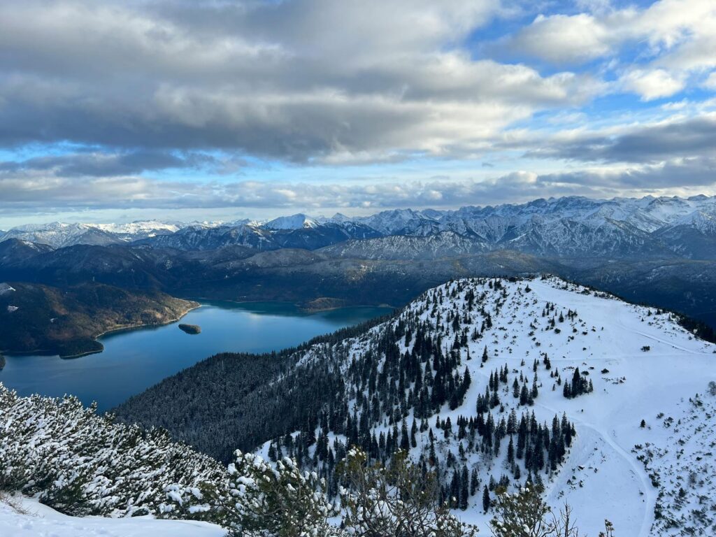
Ask a Münchner for one mountain and they will say Herzogstand. It stands above the Walchensee, which is the deep, improbably turquoise lake that appears on every Bavarian calendar, and the summit pavilion looks down on it from about 1,730 metres with the Karwendel behind.
Getting there: regional train from München Hauptbahnhof to Kochel, about an hour, then bus 9608 — the Garmisch–Mittenwald–Walchensee–Kochel service — to the Walchensee Herzogstandbahn stop. The bus is the weak link. It does not run every twenty minutes, and missing the connection at Kochel costs you an hour, so look up the specific departure rather than turning up.
On foot or by cable car: the Herzogstandbahn costs €21 adult and €6 child, runs daily from 09:00 to about 17:15, and its 2026 summer season ran from 25 April to 4 October. It removes roughly 800 metres of ascent, about two and a half hours, and drops you fifteen minutes below the summit. Walking up takes two to two and a half hours on a broad, well-made path with no difficulty at all; coming down takes about an hour and a half.
Here is the honest verdict: walk up, ride down. The ascent is a good, steady, entirely safe climb and it is the part that earns the view. The descent is 800 metres of the same path with tired knees and nothing new to look at, and €21 for a cable car is cheap for what it saves you. Doing the reverse — riding up and walking down — is the most common choice and the least satisfying one.
The Herzogstand–Heimgarten ridge — read this before you commit
From Herzogstand a ridge runs east to the Heimgarten, and traversing it is the walk that fills Instagram. It deserves its reputation and it also deserves a warning, which most write-ups bury.
The full round is about 15 kilometres with 1,100 to 1,200 metres of ascent, and six to eight hours on your feet. The ridge itself is a proper alpine path: narrow in places, with cable and pin protection at the exposed sections, and a long drop on both sides. The protection is good. It is still, unambiguously, a route that requires sure-footedness and a head for heights, and it is not a walk to attempt in trainers, in poor visibility, or as your first mountain of the year.
The descent from Heimgarten to Ohlstadt or back down to Walchensee adds a thousand metres of knee-punishing downhill after you are already tired, which is where most incidents happen. If you have any doubt, do Herzogstand alone and look at the ridge from the summit. It will still be there next year.
Insider tip: the last bus back from Walchensee to Kochel is the hard deadline on this route, and it is earlier than people expect. Work backwards from it before you start, not at four in the afternoon on the ridge.
Wendelstein — the one with the cog railway
The Wendelstein rises to 1,838 metres above the Inn valley and carries a summit chapel, an observatory and a weather station, which tells you how long people have been going up it. Two lifts serve it: the historic Zahnradbahn cog railway from Brannenburg and the cable car from Osterhofen near Bayrischzell, which is reached from Munich on the BRB RB55 in about eighty minutes.
The cog railway costs €34 one way and €43 return for an adult, €21.50 for a child return. Departures start around 09:15 and run about half-hourly with a midday break, with the last descent at 17:00; the cable car runs hourly from 09:00 with a last descent at 17:00. Both timetables are seasonal — check them the week you go.
On foot from Osterhofen it is roughly 12.6 kilometres and about 1,050 metres of ascent, five hours of walking. That is a real day out, and the summit area is busy with lift passengers when you arrive, which some people find deflating. The compromise most locals make is to walk up and take the cable car down, or to ride up and walk down to Brannenburg on the other side, turning it into a traverse.
Be aware of the BRB’s carriage split. The train leaves Munich as one three-part set: the front portion goes to Bayrischzell, the middle to Lenggries and the rear to Tegernsee. It uncouples the Bayrischzell portion at Holzkirchen and splits the other two at Schaftlach. Sit in the wrong carriage and you will arrive in a different valley — a mistake that costs about two hours.
Wallberg — steep, short, and the best view over Tegernsee
The Wallberg sits at the southern end of the Tegernsee and gives you the whole lake laid out below with the Alps behind. It is reached via the BRB RB57 to Tegernsee, about 65 minutes, then a local bus around the lake to Rottach-Egern.
From the valley station it is about two and a half hours up and two and a quarter down, on a path that does not mess about — it is roughly a thousand metres of ascent packed into not very much horizontal distance. The Wallbergbahn cable car covers most of it if you would rather not. If you start from the Wallbergmoosalm instead, it is about an hour and three-quarters.
The unflattering part: the Tegernsee valley is expensive and knows it. A coffee at the top costs what a meal costs elsewhere, and the lakeside towns are more Bavarian Riviera than Bavarian village. Come for the mountain and eat before you get there.
The Prinzenweg — Schliersee to Tegernsee
A point-to-point walk over the ridge that separates two lakes, and the most elegant use of the BRB’s branch lines: out on one, back on the other. Fourteen kilometres, about 600 metres of ascent, four and a half hours. Munich to Schliersee is about an hour.
The route climbs from Schliersee over the Neureuth and drops into Tegernsee, and because it never gets very high it stays walkable into November when the summits are already iced. It is also the hike where nobody has to double back or wait for a bus — you finish at a station. The Neureuth hut above Tegernsee is the natural lunch stop and is one of the few in the valley that has not been priced into the stratosphere.
Blomberg — the family mountain
The Blomberg reaches 1,248 metres above Bad Tölz, which is about 55 minutes from Munich on the BRB. The round walk is 7.6 kilometres with just over 500 metres of ascent, and about two hours up if you take the more scenic line over the Heiglkopf.
What makes it the pick for families is the base station: a chairlift and a summer toboggan run, which means the walk has a reward that children actually want. Bad Tölz itself has a painted-facade old town worth an hour afterwards. It is not a spectacular mountain and nobody would claim otherwise — it is a very good afternoon. Our guide to Munich with kids has more in this category.
Around Garmisch: gorge, lake and glacier
Garmisch-Partenkirchen is 1h20 to 1h26 from Munich on the hourly RB6 Werdenfelsbahn, direct, and it is the single best base for a walking day in the mountains. Three options radiate from it.
Partnachklamm
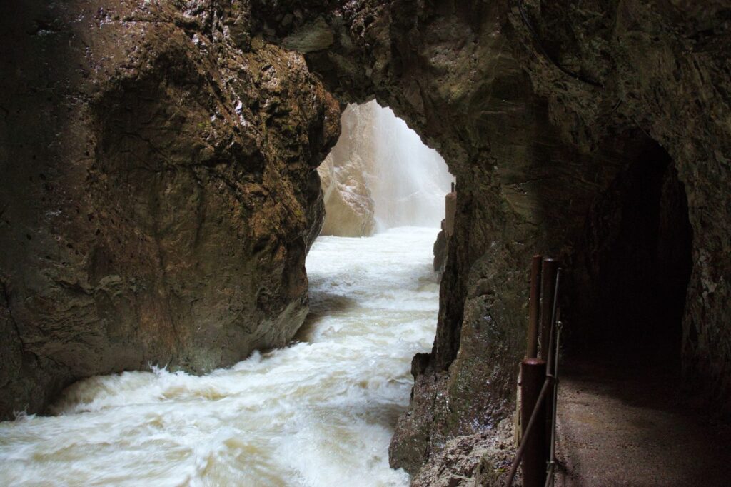
The Partnach gorge is about 700 metres long, costs around €10 to enter, and is a walkway hacked into a slot canyon with the river hammering through a metre below your feet. It is genuinely spectacular and it is genuinely not a hike — you can do the gorge itself in twenty minutes.
Make a day of it by continuing up to the Eckbauer and coming down by cable car or on foot, which turns a twenty-minute attraction into a four-hour circuit with lunch on a meadow. The gorge is open year round but closes at short notice in bad weather, most often in winter after ice fall. Check before travelling; a closure discovered at the ticket window has ruined a lot of days.
The Eibsee circuit
The Eibsee sits at the foot of the Zugspitze and the loop around it is roughly seven and a half kilometres, essentially flat, about two hours. The water is the colour of a swimming pool and the north face of Germany’s highest mountain fills the sky above it. There is no better ratio of scenery to effort anywhere in this article.
Reach it on the Zugspitzbahn from Garmisch. It pairs naturally with a summit trip — see our full Zugspitze from Munich guide — and if you are going up the mountain anyway, note the MVV Garmischer Sommerticket, on sale from 14 May 2026: €94.50 adult for return travel from Munich plus the cog railway, Gletscherbahn and Seilbahn Zugspitze, against €34 for a Bayern-Ticket plus €78 for a Zugspitze return bought separately. The Classic variant, at €60.50 adult and €8 child, covers travel plus the Alpspitzbahn, Hochalmbahn and Kreuzeckbahn — which is the one to buy for a walking day rather than a summit day.
Alpspitze and the Höllentalklamm
The Alpspitzbahn lifts you to 2,050 metres in a few minutes, and the walks from the top station range from a twenty-minute panorama loop to serious high-alpine routes. The Höllentalklamm, on the other side, is a wilder and longer gorge than the Partnachklamm and the approach walk from Hammersbach is substantial. Both are worth doing and both need more than a casual look at the map — see our Garmisch-Partenkirchen day trip guide and the wider Bavarian Alps from Munich hub for how they fit into a day.
What is not worth the journey
Being useful means saying this part out loud.
- Any “hike” that is a forest road to a viewpoint. Several Voralpen summits within an hour of Munich are ninety minutes of gravel track through spruce plantation, ending at a hut with a view of more spruce plantation. Hohenpeißenberg has a genuinely good Alpine panorama and a historic observatory; several of its neighbours do not, and the write-ups read identically.
- Starnberger See’s eastern shore. Closest lake to Munich, most built-up shoreline, and long stretches where the path is squeezed between a fence and the water. The Ilkahöhe above Tutzing on the western side is the exception and is a lovely two-hour afternoon. The rest is better swum than walked.
- Neuschwanstein as a walking day. The Marienbrücke and the Tegelberg above it are excellent. Getting there is two hours to Füssen plus bus 78, and the castle end of it is one of the most crowded places in Germany. If you want the mountain, go to Garmisch. If you want the castle, treat it as its own day — our Neuschwanstein day trip guide covers the timed entry, which books out weeks ahead.
- Chasing the Zugspitze summit on a hiking day. Walking up the Zugspitze from the Höllental or the Reintal is a genuine mountaineering day of eight to ten hours, often with a hut night. The version most visitors mean — riding up — is a sightseeing trip, not a hike, and costs €78 return. Both are worth doing. Neither is a day hike.
Season by season
| Season | What works | What to avoid |
|---|---|---|
| April–May | Andechs, Osterseen, the Isar, low ridges like the Prinzenweg | Anything above ~1,500 m — old snow on north sides into June |
| June–August | Everything. Herzogstand, Wendelstein, the high Garmisch routes | Afternoon thunderstorms; be off ridges by 14:00 in July |
| September–October | The best month. Stable air, long views, autumn colour, empty paths | Cable-car seasons end in early October; check before relying on one |
| November–March | Isar valley, Osterseen, Ammersee shore, Partnachklamm in ice | Every summit route unless you have winter kit and know how to use it |
Two things about Bavarian weather that are worth internalising. Munich gets around 130 wet days a year, concentrated in June and July — the two months everyone books. And afternoon thunderstorms in high summer build fast and arrive with real violence; the mountain rescue statistics are dominated by people caught high and late. Start early. Our Munich weather and packing guide has the wider picture, and the best time to visit Munich covers the seasonal trade-offs across the whole trip.
What to take
- Boots with ankle support for anything above the treeline. Trainers are fine for Andechs, the Osterseen and the Isar; they are not fine on the Herzogstand ridge, and the local mountain rescue will tell you so at length.
- A hard shell regardless of the forecast. Alpine weather turns in twenty minutes and the temperature drops roughly 6°C per thousand metres before you add wind.
- Cash. Mountain huts in Bavaria are cash-only more often than not, and mobile signal on a ridge is unreliable. Two hundred euros of card-only planning has left a lot of people paying for a Radler in coins.
- More water than feels necessary. Huts sell drinks but they are two hours apart, and Bavarian huts often charge more for water than for beer, which is a trap in both directions.
- The physical timetable for your return bus, screenshotted. Coverage in the valleys is patchy and the DB app is useless without it.
Everything is buyable in Munich if you have arrived without it — the outdoor shops cluster around the Marienplatz end of Sendlinger Straße and along Rosenheimer Straße. See our Munich shopping guide, and note that shops shut on Sundays across Germany, so a Saturday-evening realisation is your last chance before a Sunday walk.
Frequently Asked Questions
Can you really hike near Munich without a car?
Yes, and better than in almost any comparable city. Every hike in this article is reachable on public transport, and the Bayern-Ticket covers regional trains and most connecting buses across the whole of Bavaria for €34 solo or €74 for up to five people. The one thing a car buys you is flexibility at the far end — some valley buses run only a handful of times a day, so you plan around a timetable rather than a whim.
What is the easiest hike near Munich for a first-timer?
Herrsching to Kloster Andechs. The S8 runs there directly in about 45 minutes, the walk is four kilometres with 140 metres of height gain through the Kiental, and it ends at a monastery brewery. Nothing about it requires experience or equipment. The Osterseen circuit at Iffeldorf is the next step up — longer at ten to twelve kilometres, but essentially flat.
Is the Herzogstand–Heimgarten ridge dangerous?
It is exposed rather than technical. The ridge has cable and pin protection at the awkward sections and is walked by large numbers of people in summer, but there are long drops on both sides and it needs sure-footedness and no fear of heights. It is a six-to-eight-hour day with 1,100 to 1,200 metres of ascent. If you are unsure, walk Herzogstand on its own — the summit view is most of the reward, and you can look at the ridge before deciding.
How much does it cost to get to the trailheads?
The Bayern-Ticket at €34 covers a solo day; two people or more should always buy the group version at €74 for up to five. Add cable cars where you use them: Herzogstandbahn €21 adult, Wendelstein cog railway €43 return, Partnachklamm entry around €10. A full day on the Herzogstand with the cable car down and a hut lunch comes in around €60 to €70 per person; the Osterseen or Andechs costs the ticket and whatever you eat.
When does the hiking season start in the Bavarian Alps?
Low routes below about a thousand metres are walkable from April. Summits above 1,500 metres often hold old snow on north-facing slopes into June, which is when most accidents involving unprepared walkers happen. Late June to early October is the reliable window, and September is the best month of the year — stable air, long views and far fewer people than August. Cable-car summer seasons typically end in the first week of October.
Are there hikes near Munich suitable for children?
The Kiental path to Kloster Andechs handles pushchairs. The Osterseen circuit is flat and has swimming. The Blomberg above Bad Tölz has a chairlift and a summer toboggan run at the base, which is the bribe that makes a 500-metre climb acceptable to a seven-year-old. The Eibsee loop is flat with a spectacular backdrop. Avoid anything with a ridge, and avoid the Wallberg’s gradient.
Do I need to book mountain huts in advance?
Not for a day hike — you are eating and leaving, and huts on these routes seat walk-ins. Booking matters only if you are staying overnight, which none of the walks here require. Do carry cash: a great many Bavarian huts still do not take cards, and the ones that do often have a minimum.
Can you hike near Munich in winter?
The valley walks work all year: the Isar through the Pupplinger Au, the Osterseen, the Ammersee shore, and the Partnachklamm in full ice, which is arguably better than in summer. Summit routes need winter equipment and the judgement to use it — snowshoes or crampons, and an understanding of avalanche risk. Do not treat a summer route description as valid in February. Our Munich winter guide covers what the season actually offers.
Is the Bayern-Ticket valid on the mountain lifts?
No. It covers regional trains and most regional buses, and it gives a discount on the Zugspitzbahn, but cable cars, cog railways and chairlifts are separate purchases. The exception worth knowing is the MVV Garmischer Sommerticket, which bundles the return journey from Munich with the lifts — €60.50 adult for the Garmisch-Classic mountains, €94.50 for the Zugspitze — and beats buying the two parts separately.
Where to go next
If you have a whole day and want the mountains without the effort, our Bavarian Alps day trips ranks the non-walking options, and Garmisch-Partenkirchen is the base most of them share. For water rather than height, the lakes near Munich covers the swimming. If you are fitting a walk into a wider trip, three days in Munich shows where a day out actually belongs in the schedule, and Munich’s outdoor activities covers what you can do without leaving the city at all — including the surfers on the Eisbach, who are out there in January.
Related Guides
- The Bavarian Alps from Munich: Complete Mountain Guide — the cluster hub
- Zugspitze from Munich: Germany’s Highest Peak — Major untargeted head term; SERP is tour operators, no authority guide
- Garmisch-Partenkirchen Day Trip from Munich — Top-five Munich day trip with no page on the site
- Skiing Near Munich: Best Resorts for a Day on the Slopes — November to March traffic the site currently captures none of